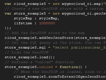
Add maps to your own apps
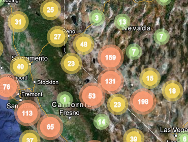
Visualize your data on maps. Just use HTML and JavaScript through a powerful API for adding maps to your own app or web site. Learn more.
Build on open source software
The core component of MyGeoCloud is the rock solid PostGIS database with endless possibilities. If you can think the analysis you can do it. Learn more.
Manage data
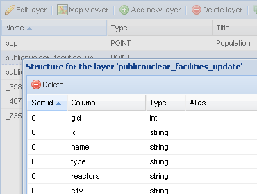
With a powerful adminstration tool you can manage your data online. Get full control from every where.
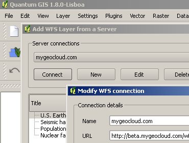
Maintain your data
You can edit your data sets from any application, which supports the WFS-Tstandard. We recommend the desktop application QGIS, which is OpenSource and runs on Linux, MacOSX and Windows.
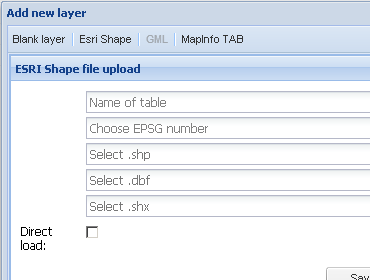
Upload your data
Upload your existing data to your MyGeoCloud database. At the moment you can upload Shape files and MapInfo Tab files, but soon we will add more like GeoJSON og GML.
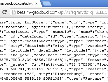
Use spatial SQL
With the SQL API you can fire any SQL query for accessing your data. You can use the API on web sites, in apps and on servers. And in any programming language. Learn more